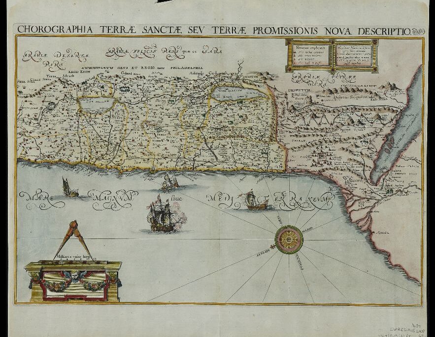
In the absence of precise documentation, scholars are divided as to what route the ancient Hebrews took on their way from Egypt to Canaan. But the maps preserved in the Eran Laor Collection at the National Library of Israel show many possible routes of the long journey that the Hebrews took in the desert during their 40 years of wandering.
"The National Library has about 300 maps showing the Exodus from Egypt," says Ayelet Rubin, who manages the map collection. "The route varies slightly from map to map. Every painter, cartographer or artist painted it a little differently. Most of the maps, even those written in Hebrew, are from Christian sources."
The collection also contains a number of maps in Hebrew taken from Passover Haggadot. "Some of the maps were included in copies of the Tanakh and depict the Exodus from Egypt. The maps were used as an illustration for the Holy Scriptures, mainly for rich people, who read these books in the evening at home. After all, they didn't have a television."
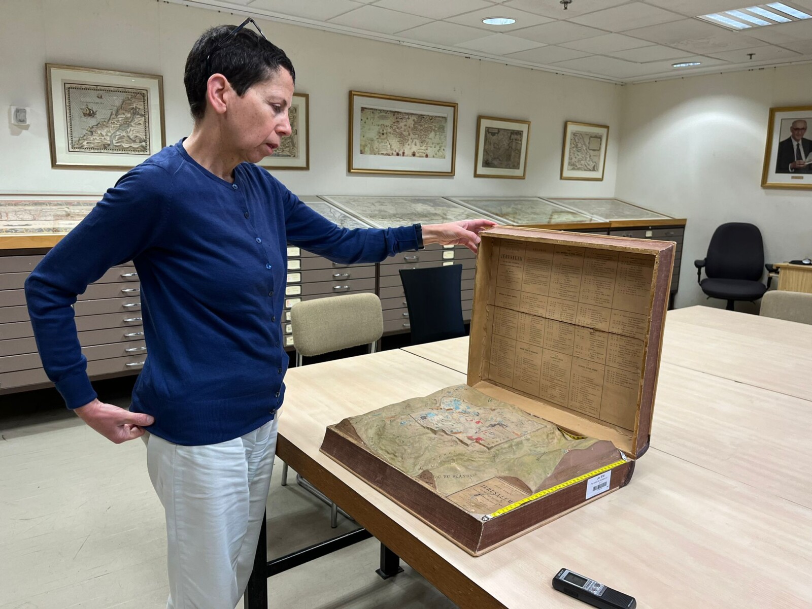
The first maps, Rubin explains, were printed using a woodcutting technique. Later, copper engraving became more common. "On these kinds of maps, we won't look for geographical accuracy," Rubin says. "Until the 16th century, there were no tools for drawing maps with accurate measurements. In most of them, the religious side is very prominent."
Beginning in the 19th century, travelers and explorers who traversed the Holy Land and the Sinai Peninsula came to the Land of Israel to find the wandering route of the Hebrews in the desert and the stops of their journey, with the attempt to locate Mount Sinai at the center of the investigations. These researchers wrote travel diaries and drew maps based on field visits.
Ayelet Rubin spoke with Davar to tell the stories of some of the most notable maps in the collection.
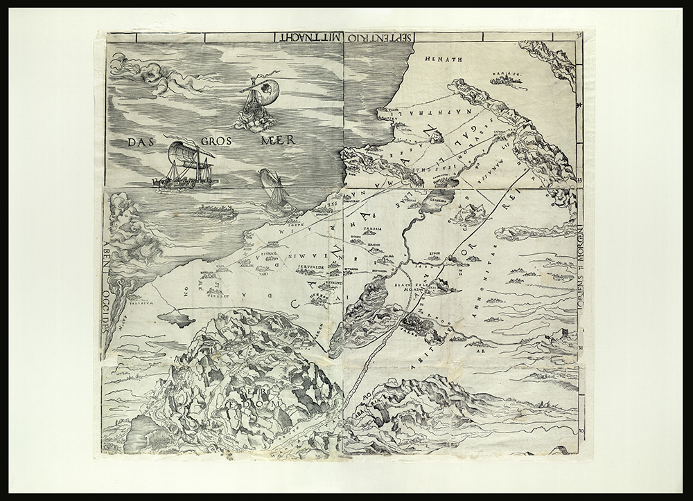
The Ancient: The oldest map of the Exodus in the collection is from 1515. "The map was printed by Lucas Cranach the Elder (1472-1553), who was a German painter and wood engraving and print artist. He was active during the Renaissance and was court painter to the Prince of Saxony. This is a special map, which is the only copy in the world that has been preserved.
"The map is based on Frederick III's journey from Saxony to the Land of Israel, and includes illustrations of events from the story of the Exodus: the copper serpent, the golden calf, Moses on Mount Sinai. This is a very important map. It's a discrete, independent map not connected to a book."
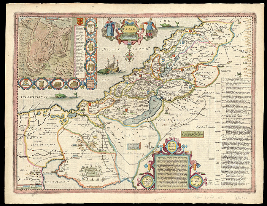
The Royal: "This map was printed in London by John Speed (1552-1629), who was an English cartographer and historian and is considered to be the best-known English mapmaker of the Stuart period. So much so that Queen Elizabeth I gave him a study at the Customs House in London.
"The map appears under the heading 'Land of Canaan.' It was dated 1611 and included in Speed's Genealogies Recorded in the Sacred Scriptures, which was inserted into the King James Bible. The map was printed on copper engraving and shows the route of the Exodus from Egypt; The route (in yellow) begins in Egypt, you can see the route, the Tabernacle, the story of the sin of the golden calf, the copper serpent and Moses standing on Mount Sinai. There is a breakdown of the names of the stations: Raamses, Sukkoth, Etham, everything is taken from the Bible. The map was not created by a person who visited the Land of Israel, but was rather created by someone following the biblical story."
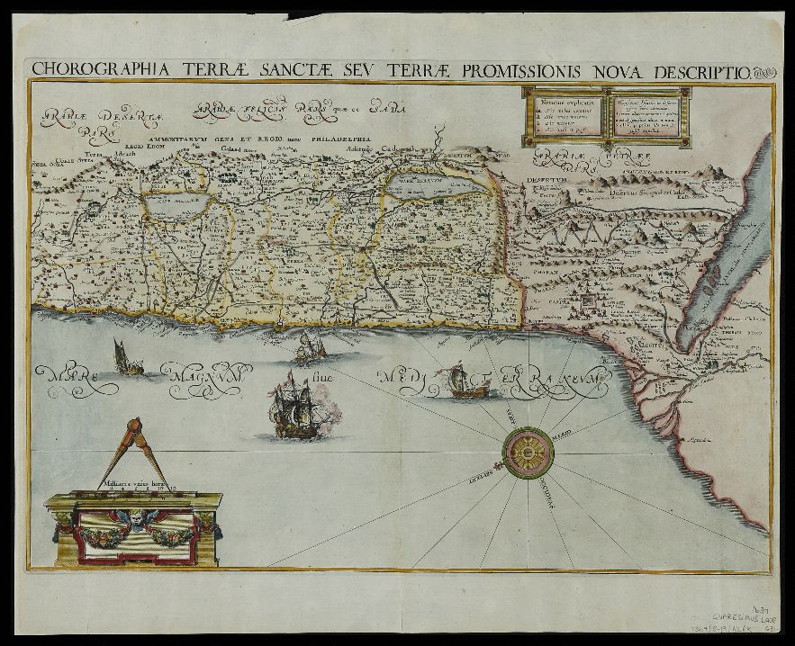
The New: "This is a map from 1639 that was added to the Library's collections as a donation from collector Howard Golden at the end of 2022. It is a painted map, which, after printing, was sent for special coloring. In it you can see the route of the Exodus and the division of the land into the tribes of Israel. You can see the great similarity between the maps, because different creators in different years undoubtedly copied from each other."
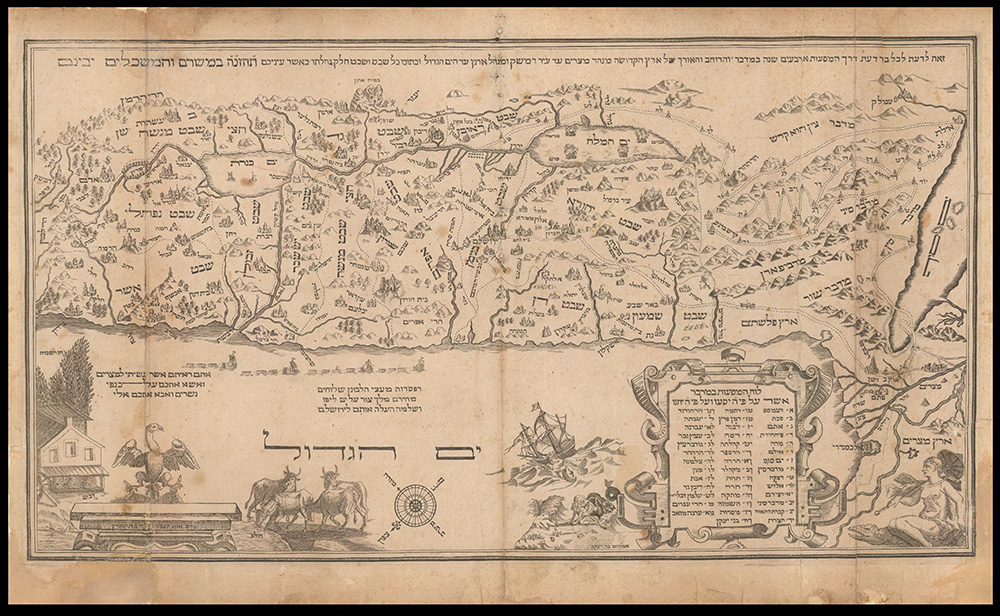
The Dutch: "This is a Hebrew map from the 'Amsterdam Haggadah' from 1695. The route here is similar to the previous maps, only there is a loop in the Red Sea, and it even illustrated the 12 memorial stones that Joshua erected after the Jordan crossing. We know that the Land of Israel is a land flowing with milk and honey and you can see on the bottom left side the cows and beehives drawn through European eyes. The map shows the lands of the tribes of Israel, and a beautiful illustration of a dove thrown from a ship and a big fish waiting for it.
"The picturesque and visual aspects of maps are very strong. Different maps have illustrations both in and around the body of the map. You can see beautifully the sinking of Pharaoh's troops in the Red Sea, Mount Sinai and Mount Horeb, sometimes the explicit name of G-d appears above the image of Moses standing on Mount Sinai."
***
Eran Laor, born in Slovakia, worked in the Allied secret service, assisted in bringing olim to Israel, and after the establishment of the State of Israel served as a representative of Israel’s national institutions in Europe. In 1975 he donated his cartography collection to the National Library of Israel. The collection today includes ancient maps – starting in the 15th century – ancient atlases, travel books in the Land of Israel and around the world, guides, books by researchers of the Land of Israel from the 19th century, books on historical geography, biblical dictionaries, and volumes of the Bible and New Testament in which maps are included.
This article was translated from Hebrew by Benji Sharp.


